Mapping and Delineating Upper Feather Watershed
Mapping and Delineating Upper Feather Watershed
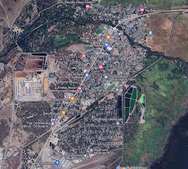
This map shows the area of which Upper Feather Watershed occupies. It is about 3,586 sq. mi., 252 miles. It spans across multiple towns including Chester, Johnsville, Stirling City, etc.
There are multiple creeks and lakes within the watershed with many different elevation changes. There are also many main roads that go through the watershed including Rt. 70, Rt. 89, Rt. 36. There are many reservoirs in the area including little grass valley reservoir, mountain meadows reservoir, Butt valley reservoir, and round valley reservoir. There are also many tributaries in this watershed. Below is an example of one. It shows Lake Oroville, with multiple streams and creeks going into the lake. This lake was made by the Oroville dam, and it provides water to many homes in the San Francisco Bay area, the San Joaquin Valley and Southern California. If you want more information on this lake, follow the link below.
https://www.parks.ca.gov/?page_id=462
Due to how large this watershed is, I am going to take a smaller section of it to examine. The first section I am going to observe is Miller Fork Creek.
Miller Fork Creek is about 1.14 sq. mi., 4.86 miles and has an elevation that goes up to 5,400', and as low as 5000'. Ohv rd. 48 goes along side the stream. It is in the middle of no where with multiple campgrounds close by including Deans Valley Campground, Rock Creak Campground, and Whitehorse campground. The closest civilization is University of California Forestry Camp, and Meadow Valley. Lets look at one more creek that runs though Upper Feather Watershed.
This creek, Fells Creek, is about 2 sq. mi., 7.68 miles. It has an elevation change that goes up to 4,800' and as low as 4.000'. It branches off of Middle Fork Feather River with Old Spring Garden Rd. going around it. Redbridge campground is close by and Spring Garden is the closest civilization. The river that this creek attaches to (Middle Fork Feather River), eventually leads into Lake Oroville (see Picture above), making this river a tributary.
Feather Falls Waterfall is along Middle Fork Feather River. This waterfall has a 410 foot drop and the hike is about 7-9 miles long depending on which trail you take.


Comments
Post a Comment